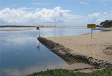
Safer boat operations—Maroochy River
 A marine safety system has been put in place for the Maroochy River.
Some key elements of this system are:
- warning signs to warn waterway users of specific hazards or obstructions
- signs for speed limits
- speed limits of 6 knots for all vessels in the upper reaches of creeks
- a speed limit of 20 knots for all vessels upstream of the David Low Bridge through shallow areas near the Wetland Sanctuary and the Bli Bli Islands
- water skiing prohibitions, including an area of Eudlo Creek where only boats up to 6.4m with 1 tow line may water ski on the creek.
These requirements complement other marine safety and waterways management legislation. They also provide a simple, cost-effective regulatory system to advance marine safety on an important Sunshine Coast waterway.
Maps of speed limits and water skiing prohibitions
The maps below show the speed limits and water skiing prohibitions, along with the system of regulatory and warning signs.
- North and south Maroochy River to Brown’s Rocks (area 1)
- Brown’s Rocks to near Dunethin Rock (area 2)
- Near Dunethin Rock to the cane train bridge (area 3)
- Cane train bridge to downstream of Coolum Creek (area 4)
- Downstream of Coolum Creek to David Low Bridge (area 5)
- David Low Bridge to upstream of Sunshine Motorway Bridge (area 6)
- Upstream of Sunshine Motorway Bridge to Maroochy Bar (area 7)
- Coolum Creek
- Petrie and Paynter Creeks
- Eudlo Creek

