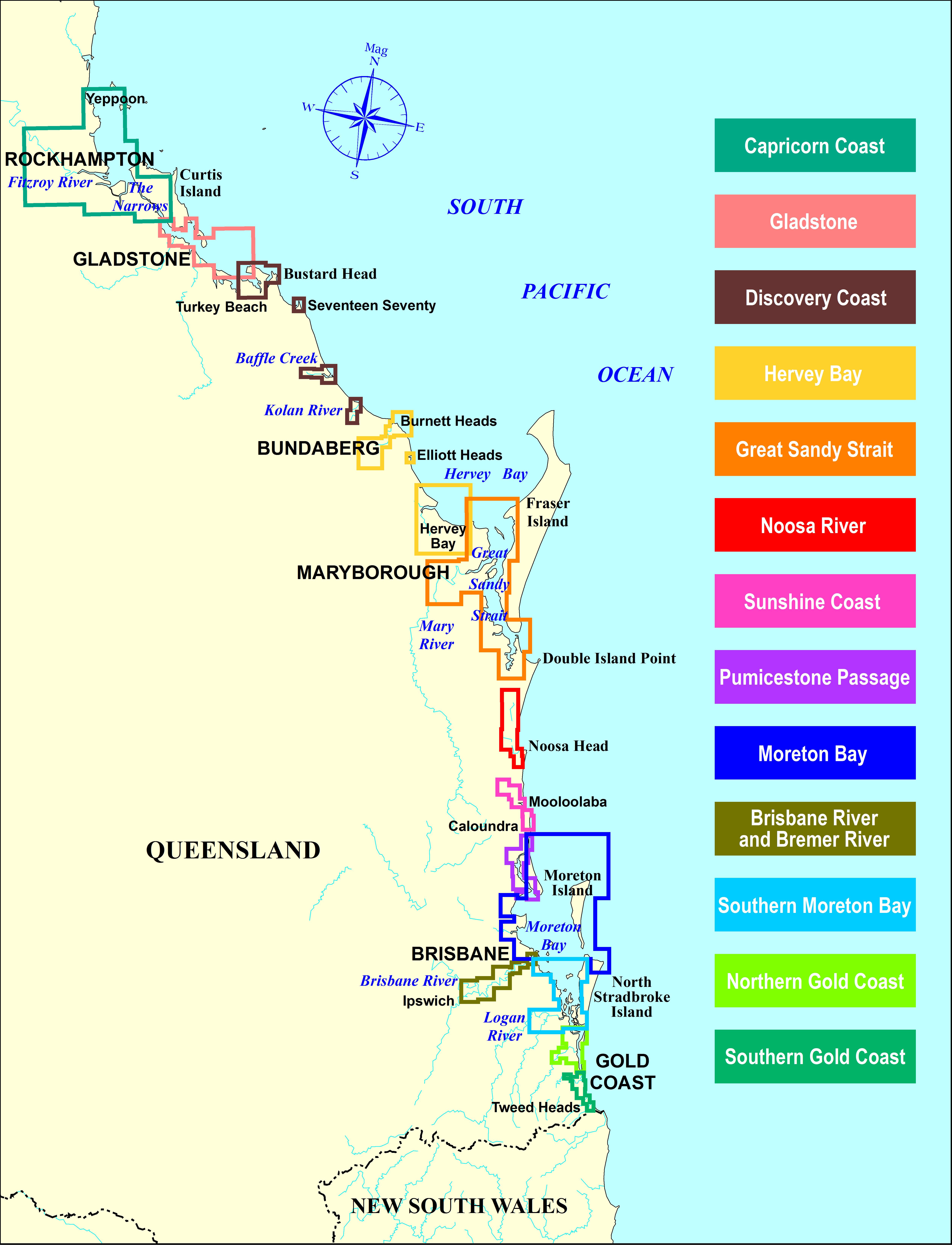
Beacon to Beacon Guides
Maritime Safety Queensland’s Beacon to Beacon Guides provide navigation maps for selected waterways from the southern Gold Coast to Keppel Bay and Rockhampton.
The maps are intended for recreational boating and should be used as a guide for navigation.
Care should be taken when navigating outside waterways not marked by navigation aids.
Comprehensive navigation charts for ports and offshore areas are published by the Australian Hydrographic Office.
A comprehensive legend with map notes is available as a separate, free download and can also be found on the same page as the booklet downloads.
Maps may be printed as often as needed and can be easily slipped into standard plastic folder sleeves.
The maps are updated as required or alternatively, you can update your printed maps manually from information on the Queensland Notices to Mariners page.
Although the maps are suitable for navigation under the IALA buoyage system, some of the symbol standards have been modified for use in Queensland. For example, buoy symbols are often shown in similar shape and colour of the actual buoy—as they are seen on the water.
Beacon to Beacon Guides are free. Choose and download the relevant Beacon to Beacon Guide from the map or the list below.
Please read the terms and conditions found on each download page before downloading and reproducing these guides.


